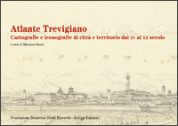
Atlante Trevigiano
Cartografie e iconografie di città e territorio dal XV al XX secolo
[Atlas of Treviso. Maps and other illustrations of town and territory from the XV to the XX century]
catalogue edited by Massimo Rossi
Fondazione Benetton Studi Ricerche-Antiga Edizioni
Treviso 2011, 108 pages
61 illustrations in colour and 19 black and white
25 euros, ISBN 978-88-88997-45-2
(catalogue of the exhibition organized by the Fondazione Benetton Studi Ricerche, Treviso, spazi Bomben, 22nd January-17th April 2011)
The exhibition of which this publication is the catalogue started with a private collection of printed maps and developed a broader cultural focus, restoring each exhibit to the organic context from which it originated and illustrating the history of how places have been depicted in Europe. The Vianello Bote Collection, recently acquired by the Fondazione Benetton Studi Ricerche, covers a period of five centuries and includes examples of the work of the Dutch, French, German, English and Italian map publishers who produced the most important commercially available atlases between the XV and XIX centuries. As well as exploring the close and complex social relations which ensured that the way printers, publishers, geographers, humanists, technicians and artists at both local and international levels depicted places kept pace with the morimportant developments in publishing in Europe, the exhibition and its catalogue also offers consideration of the ways in which collections of antique prints are assembled. The result of decades spent cultivating dealers and combing antique fair stalls is often the product of the defilement of original books, many of which came from public libraries. Maps and views of cities and regions are cut or torn from atlases or geography books, decontextualized and mounted in passe-partouts, in turn to be sealed in frames and hung on walls for effect. Through Atlante Trevigiano we also attempted to reflect on the ways maps are made, now as in the past mirrors of cultural context and social ability to interpret and depict territory. The exhibition created frameworks for dialogue between antique maps and their modern counterparts, between an early XIX century view and what one sees from the same viewing point today. All with a single underlying purpose: to continue to foster a critical vision of the world on the basis of documented research, an activity that remains an absolute pre-requisite for any discussion of or planning for our future.
Massimo Rossi, a geographer, graduated with honours in Humanities at Ferrara University in 1986. He won a scholarship to study at the Smith Center of the Newberry Library of Chicago (1989) and worked as coordinator of the Historical Archive of Cartography of the Este Principate at the Institute of Renaissance Studies in Ferrara. Since 1996 he has been in charge of the Fondazione Benetton map library; he also coordinates the History of Cartography department for the Italian Centre for the History of Geography.
His publications include: Atlante del Ferrarese. Una raccolta cartografica del Seicento, Panini, Modena 1991; Kriegskarte, 1798-1805. Il Ducato di Venezia nella carta di Anton von Zach, Fondazione Benetton Studi Ricerche-Grafiche Bernardi, Treviso-Pieve di Soligo 2005; The Hereford Mappamundi or Visibile parlare, in The Hereford world map. Medieval world maps and their context, edited by P.D.A. Harvey, British Library, London 2006; L’officina della Kriegskarte. Anton von Zach e le cartografie degli stati veneti, 1796-1805, Fondazione Benetton Studi Ricerche-Grafiche Bernardi, Treviso-Pieve di Soligo 2007.
Catalogue’s contents
Atlante Trevigiano, prefazione, di Marco Tamaro, 7
Ringraziamenti, 8
Elenco delle abbreviazioni, 8
Massimo Quaini, Un piccolo viatico per un cammino sicuro attraverso i paesaggi della cartografia, 9
Le ragioni di una mostra sulla cartografia storica trevigiana, 13
I documenti cartografici della città: vedute, piante, scorci, 16
Le cronache, 16
Civitates orbis terrarum, 18
Civitates orbis terrarum, filiazioni, 22
Verso la città zenitale, 27
Il contesto risorgimentale, 33
Dalle topografie cittadine di inizio Novecento al Piano regolatore del 1946, 45
I documenti cartografici del territorio, 48
Geografi italiani per atlanti neerlandesi, 48
L’età degli atlanti neerlandesi, 50
Dopo Ortelio e Mercatore: Hondius e Janssonius, 57
Gli atlanti blaviani, 60
Atlanti veneti, 62
Cartografia manoscritta: l’estimo del Trevigiano, 69
La cartografia dei militari: la visione zenitale, 70
Dal frammento al tutto, 75
Staccando l’ombra da terra, 76
Bibliografia, 79
Atlante Trevigiano. Materiali cartografici e iconografici esposti, 83
La collezione Domenico Vianello Bote nella cartoteca della Fondazione Benetton Studi Ricerche, 96
Appendice
Antonio Prati, Idea topografica del Trevigiano, 103
